One of the few "in-depth" reviews that I've done was for Waze. I still use Waze but Google Maps has a lot of great features that Waze lacks and there are certain features that they both share.
Google Maps remembers your home, work, and places that you have visited in the past. This is helpful for someone forgetful like me who remembers the street name or place name but not the exact address.
Google maps can tell you about places near you that are: restaurants, parks, gas stations (and their prices, groceries, pharmacies, and much more.
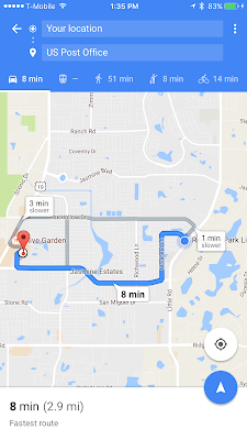
Routes are available for car, walking, bicycling, and mass transit (all kinds actually). I found this feature incredibly useful in Portland, Oregon. It would tell me when the bus would come by the bus station near me, how long it would take to get to the destination, and how much it would cost. There were times that I could see that walking would take the same amount of time. I could also get an alert from the app when it was time to leave the house and head to the bus stop.
As a Google Maps user you can easily provide reviews and user data about places you visit. You collect points and there is a program in place to provide rewards.
If you want a satellite or terrain view that's available in the app as well. With one of the most recent updates you can also download maps for offline viewing so if you are using a tablet or have a limited data plan you can download your map for later use.
The "Explore" feature gives you suggestions for places that you might enjoy for different categories.
The app has voice recognition so you can search for a place without typing, which is especially helpful when driving. The app shows traffic on the map and alerts you when you to changing traffic. Unfortunately I do not have a screenshot but one of the other things that is helpful is the app shows arrows in the top left of the screen of where each lane is going so you can decide what lane you want to get in or avoid. Another new feature is that the app will tell you the speed limit of the road you are traveling on. If you prefer to just look at the turn by turn instructions you can tap the grey bar at the bottom where it lists the amount of time and it will show you each turn and the distance between each turn.
With 3D Touch on iPhone 6S and 7 you can press to launch a quick navigation to your shortcut locations. If you have an Android you can set-up widgets that show you how long it would take to drive from your current location to each of your shortcuts.
Google Maps is available for:
Android - https://goo.gl/fjwt1
Apple (iOS) - https://goo.gl/4btbGI
Online - https://www.google.com/maps/


No comments:
Post a Comment